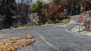
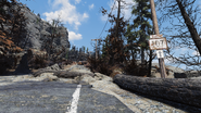
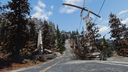
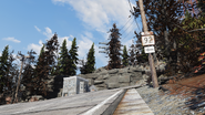
The following roadways were once thoroughfares of their respective regions, seen or mentioned throughout Appalachia.
Background[]
The majority of named roads in Appalachia are state routes and city-specific roadways. Many are named after local businesses. Alongside local roadways, there are also main interstates and highways that transect the region. Several directional street signs notating locations are found on or below overpasses or being repurposed as building materials. Some signs have worn away over time and are no longer legible, and some have been defaced with graffiti.
There are several different varieties of roadways, indicated by pre-War signs. National interstate signs are in the shape of a shield, colored in red and blue. State highways are seen as a similar shield shape but black and white. State routes are square or rectangular in shape in black and white. City and directional signs are rectangular, green with white lettering. All even numbered roadways are marked east to west, whereas odd numbered roadways are marked north to south.
Major roadways[]
Interstates[]
| Street | Image | Layout |
|---|---|---|
Interstate 59
|

|
Begins branching off of state routes 92 and 94 near Grafton, progressing southbound. Highway 64 merges with I-59 near the Landview Lighthouse, running south through the Forest, crossing the New River Gorge Bridge, swinging past the Giant Teapot and Charleston Station. Between Charleston and the Whitespring Resort, it merges into and continues on as Highway 62. |
Highways[]
| Street | Image | Layout |
|---|---|---|
| Highway 61 | 
|
Marked north to south. Begins off of Highway 64 around Grafton Dam, running northbound toward the Pioneer Scout camp and ending near the Clarksburg Shooting Club. |
| Highway 62 | 
|
Marked east to west. Serves as the border of the Whitespring grounds to the east. Behinds north of the resort and progresses southbound, turning west toward the Miners Monument and ending in Charleston. |
| Highway 63 | 
|
Marked north to south. Behinds south of Fort Atlas, traversing southbound past Top of the World before merging with Highway 62 before reaching the Whitespring. |
| Highway 64 | 
|
Marked east to west. Splits from I-59 near Gorge Junkyard and heads east before merging into Highway 61 near Grafton Dam. |
| Highway 65 | 
|
Marked north to south. Runs through much of the Cranberry Bog and the Mire. Begins north of Watoga, passing through the abandoned Bog Town and RobCo Research Center. In the Mire, it passes through Valley Galleria, the western end of Harpers Ferry, Crevasse Dam and Dyer Chemical, before ending near Abbie's bunker and merging into Highway 66. |
| Highway 66 | 
|
Marked east to west. Runs from Abbie's bunker to Red Rocket Mega Stop, before merging with Highway 63 in the Savage Divide near Fort Atlas. |
State routes[]
| Street | Image | Layout |
|---|---|---|
| Route 61A | 
|
Branches off of Highway 61 near Grafton Dam. Runs the border of Morgantown to the east towards Fraternity Row. |
| Route 63A | Also known as Hill Road. Begins on the western side of the Whitespring grounds, heading south through the Springhill Golf Course before intersecting with state route 83A/Golf Road. | |
| Route 81 | 
|
Runs the entire western end of the map, along the Ohio River. In the Ash Heap, it passes through the town of Beckley, heading north into the Forest. There, it winds past Ohio River Adventures and Hillfolk Hotdogs, continues through Point Pleasant southbound, merging with State Route 83 near the Kanawha Nuka-Cola plant. |
| Route 82 | Unused | |
| Route 83 | 
|
Begins just south of Charleston at Highway 62. Runs through much of the central Ash Heap, passing the Rusty Pick, the Sludge Works before changing course westbound, past the air purifier sites and merging with State Route 81 just south of Camden Park. |
| Route 83A | 
|
Two separate segments run both north and south of Highway 62. The northern section serves as the southern border of the Whitespring grounds, also known as Golf Road. The southern loop runs from State Route 93 in the east, past Big Bend Tunnel West and Lake Reynolds, then merging with State Route 83. |
| Route 84 | 
|
Running along the southern reaches of the region, branching off of State Route 83 near Hornwright air purifier site 03 and passing abandoned mine shaft 1 and Hornwright testing site 2 before reconvening with SR 83. |
| Route 85 | 
|
A short and winding route through the state capital, State Route 85 begins at Highway 62, running north to south through the capital building ruins, and swinging northwest along the river, passing the Charleston Herald building and Hornwright Industrial Headquarters before merging back into Highway 62. |
| Route 86 | 
|
A short segment beginning directly north of the New River Gorge Bridge. Branches off State Route 86B just before Flatwoods, heading westward past the Vault-Tec Agricultural Research Center and Sunshine Meadows industrial farm before merging with State Route 81. |
| Route 86B | 
|
Begins in Flatwoods by the Green Country Lodge. Heads southbound, crossing Interstate 59 and running parallel with the railroad tracks through Sutton before cutting east through Helvetia, merging with State Route 89. |
| Route 87 | 
|
Surrounds the Summersville Lake; one end merges into I-59 near Charleston, the other merges with Highway 62 near Riverside Manor. |
| Route 87A | 
|
Connects Routes 87 and 91 by running through Summersville. |
| Route 88 | 
|
Runs from Black Mountain Ordnance Works to The Wayward, through the west-central part of the Forest. |
| Route 88B | 
|
Splits out of Flatwoods and winds north, past Green Country Lodge, and ending at relay tower EM-B1-27. |
| Route 89 | 
|
Connects to Routes 86B, 87, 91 and 95; runs along the Gauley River ends at Lakeside Cabins in the south and Morgantown in the north. |
| Route 90 | 
|
Begins at Vault 76, running northwest through the Forest. Traverses one switchback before ending at State Route 81 in front of Tyler County Fairgrounds and Dirt Track. The stretch has six sets of roadway signs and consists mostly of car accidents. Blood Eagles, and Liberators may be encountered along State Route 90 as well as Raider punk. |
| Route 91 | 
|
Splits from Route 89 near Tygart water treatment, heads north past White Powder Winter Sports before merging into Route 95. |
| Route 92 | 
|
|
| Route 93 | 
|
Circling several locations from its start at State Route 83A. Passes Hornwright air purifier site 02, Pleasant Hills Cemetery and Big Bend Tunnel West before looping around the Mega Mansions before its terminus at Hornwright testing site 3. |
| Route 93A | 
|
A short segment with Uncanny Caverns to the east and Bastion Park to the west. Begins at Highway 62 and subsequently merges into State Route 93. |
| Route 94 | 
|
|
| Route 95 | 
|
Formed near Morgantown, heads east through Bolton Greens and Monongah and moves north to the Palace of the Winding Path, where it merges with Route 98. |
| Route 95A | 
|
|
| Route 95B | 
|
|
| Route 96 | 
|
Connects several locations in the Toxic Valley, starting at Route 81, passing Hemlock Holes and the Woods Estate, ending in Clarksburg. |
| Route 97 | 
|
Splits off from Highway 61 northeast of Grafton Steel, leads northeast past Philippi Battlefield Cemetery and ends at Prickett's Fort. |
| Route 98 | 
|
|
| Route 101 | 
|
Runs from Foundation and heads south, ending at Dent & Sons Construction. |
| Route 102 | 
|
Splits from Route 101 and winds past R&G Processing Services and Mountainside Bed & Breakfast before merging with Route 93A. |
| Route 103 | 
|
An unpaved road that splits from Route 101 near the R&G Station railroad tracks, heading south to Vault 96. |
| Route 104 | 
|
|
| Route 105 | 
|
Cuts through the Savage Divide, passing Big Fred's BBQ Shack and Beckwith Farm before ending at the junction with Highway 62. |
| Route 106 | Unused | |
| Route 107 | 
|
Runs from Thunder Mountain substation TM-01 to the flooded trainyard, partly along the Savage Divide's border with both the Mire and the Cranberry Bog. It passes through Berkeley Springs, Huntersville and Fort Defiance, and merges into Highway 65 on both ends. |
| Route 108 | 
|
Connects Route 107 to Highway 65, allowing travelers to bypass Berkeley Springs by heading south of the Sunday Brothers' cabin. |
Streets[]
Berkeley Springs[]
| Street | Image | Layout |
|---|---|---|
| N Washington Street |  |
|
| S Washington Street |  |
|
| Fairfax Street |  |
|
| W Main Street |  |
The sign is behind the vendor bot in Berkeley Springs Station. |
| Market Street |  |
|
| Cacapon Road |  |
Clarksburg[]
| Street | Image | Layout |
|---|---|---|
| St. Johns Street |  |
|
| Main Street |  |
|
| Beech Street |  |
Charleston[]
| Street | Image | Layout |
|---|---|---|
| Dickinson Street | 
|
Crosses the Kanawha River via the South Side Bridge towards the state capitol heading east to west. |
| Washington Street |  |
Sign seen above I-59. |
| East Street | Seen via the namesake East Street Bank. | |
| Broad Street | Location of Victoria Peterson's former home. | |
| Oak Street | Location of George Matoukas' former home. | |
| Main Street | Robert Gardiner homicide victims' home. |
Grafton[]
| Street | Image | Layout |
|---|---|---|
| W. Boyd Street |  |
|
| Francis Street |  |
|
| W Wilford Street |  |
The home of Otis Pike was located at 316 W. Wilford Street.[1] |
Harpers Ferry[]
Helvetia[]
| Street | Image | Layout |
|---|---|---|
| Pickens Road |  |
Running through the town of Helvetia, intersects with Helvetia-Adolph Road. |
| Helvetia-Adolph Road |  |
Running through the town of Helvetia, intersects with Pickens Road. |
Lewisburg[]
Monongah[]
Morgantown[]
| Street | Image | Layout |
|---|---|---|
| Kelvin Street | 
|
Location of Fraternity Row houses, including the address for Eta Psi House. |
Summersville[]
Sutton[]
Watoga[]
| Street | Image | Layout |
|---|---|---|
| AMS East Street |  |
Starts facing east from the roundabout at AMS corporate headquarters, goes through Watoga Shopping Plaza and Drumlin Diner; intersects Destiny Dr. and Innovation East St. |
| AMS West Street |  |
Accessed by going straight from the entrance sign; passes by Watoga Emergency Services and the Watoga Transit Hub. |
| Circuit Road |  |
A road spanning the north boundary of the city, branching off from AMS West St., passing by the Watoga Civic Center and Watoga Towers, and ends intersecting into Route 65. |
| Destiny Drive |  |
A short road between AMS East St. and Innovation East St.; passes by Watoga Underground. |
| Electron Road |  |
Provides access to the Watoga Civic Center, intersects with AMS West St. deeper into the city. |
| Industry Road |  |
A short road which curves around Watoga Towers, connecting with Circuit Road and Electron Road. |
| Innovation East Street |  |
Below monorail line; passes by parking lot to Watoga High School, goes to Drumlin Diner and intersects with AMS East St. |
| Innovation West Street |  |
Goes into the city from Tomorrow Ln., below monorail line; passes by Transit Hub and Watoga Estates. An unnamed road between it and AMS West St. provides access to the Watoga Municipal Center. Ends at RobCo Blvd. |
| RobCo Boulevard |  |
Splits from Tomorrow Ln. near Watoga High and continues past the vertibird crash site to Watoga Towers before splitting off into Route 107. |
| Tomorrow Lane |  |
Accessed by turning right from the entrance sign; runs along the outside border of town before ending going into Watoga High. |
Welch[]
Beckley[]
| Street | Image | Layout |
|---|---|---|
| Ewart Avenue |  |
Whitespring[]
| Street | Image | Layout |
|---|---|---|
| Artisan's Way | 
|
Begins at Northridge Drive, laid out east to west in front of the Artisan's Row Shoppes. Merges into parking lot before Springhouse Lane. |
| Garden Drive | 
|
Begins at Spring Street in front of the fire station, runs southwest, merging into Hill Street near the Springhouse. |
| Golf Road | 
|
Serves as the southern border of the Whitespring grounds, also known as State Route 83A. Intersects Highway 62 on both the east and west ends. |
| Hill Street |  |
Begins at the merger of Garden Drive, also known as State Route 63A. Runs north to south, ending at a T-intersection with Golf Road. |
| High Street |  |
Begins at Spring Street near the main entrance. Runs east to west in front of the cottages, ending at Northridge Drive. |
| Northridge Drive |  |
Enters grounds from the north, beginning at Highway 62 near New Appalachian Central Trainyard. Runs between cottages on the northern edge of the grounds, ending at the intersection of Spring Street and Garden Drive by the fire station. |
| Paradise Court |  |
Serves as a frontage path to the cottages near the north entrance of main resort building. Begins at Garden Drive near the Whitespring tablet and ending at Hill Street by the outdoor pool. |
| Spring Street |  |
Serves as the main entrance roadway, beginning at Highway 62 and ending at Garden Drive in front of the fire station. |
| Springhouse Lane |  |
Begins at Garden Drive in front of the Whitespring tablet, providing access to the Springhouse before merging into Hill Street. |
Bridges[]
| Street | Image | Layout |
|---|---|---|
| New River Gorge Bridge | 
|
Distinct teal-painted steel arch bridge that spans the New River. Part of Interstate 59, the bridge connects the Appalachian cities of Sutton and Charleston. |
| Silver Bridge | 
|
An eyebar suspension bridge spanning the Ohio River, linking Gallipolis, Ohio with Point Pleasant, West Virginia, now collapsed. |
| South Road Bridge | 
|
Provides access to Point Pleasant along State Route 81. |
| South Side Bridge | 
|
Crossing the Kanawha River on Dickinson Street, now collapsed. |
Bus lines[]
| Line | Image | Layout |
|---|---|---|
| Green Line | 
|
Bus stops throughout Appalachia. |
Gallery[]
See also[]
- Fallout 3 roadways
- Fallout: New Vegas roadways
- Fallout 4 roadways
- Fallout 76 train stations
- Appalachian monorail


