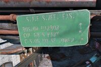
| Street
|
Image
|
Signage
|
Notes
|
Texture
|
| Arch Street
|
|
|
|
|
| Arlington Street
|
|
|
Runs north-south from Commonwealth Ave.
|
|
| Atlantic Avenue
|
|
|
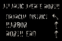
Primary road along the Boston Harbor.
|
|
| Beacon Street
|
|
|
|
|
| Berkeley Street
|
|
|
Runs north-south from the Commonwealth Avenue to Trinity Tower.
|
|
| Boylston Street
|
|
|
Runs through the Back Bay, along the south edge of Trinity Plaza.
|
|
| Charles Street
|
|
|
|
|
| Cola Boulevard
|
|
|
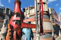
One of two streets near Nuka-station, intersects with Nuka Lane.
|
|
| Commonwealth Avenue
|
|
|
Begins at the Holy Mission Congregation, running along the south side of the Esplanade and Back Bay districts, terminating at Arlington Street.
|
|
| Congress Street
|
|
|
|
|
| Court Street
|
|
|
|
|
| Dartmouth Street
|
|
|
Runs along east side of Trinity Tower, intersecting with Boylston Street in front of Trinity Church.
|
|
| Devonshire Street
|
|
|
|
|
| Essex Street
|
|
|
East-west from the Boston Harbor inland.
|
|
| Evans Way Cul-de-Sac
|
|
|
A little residential area located near Diamond City, occupied by raiders.
|
|
| Franklin Street
|
|
|
|
|
| Humboldt Street
|
|
|
|
|
| Huntington Avenue
|
|
|
Runs northwest/southeast from Boston Public Library to the Wilson Atomatoys corporate HQ.
|
|
| Kenneth's Ridge Road
|
|
|
Connects State Route 102E to Kawaketak Station on Mount Desert Island.
|
|
| Kneeland Street
|
|
|
Connects Mass Bay Medical Center with Atlantic Avenue.
|
|
| Lagrange Street
|
|
|
Runs along the east side of Combat Zone, swinging around and intersecting one end of Tremont Street.
|
|
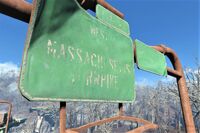
| Mass Avenue
|
|
|
North-south from Cambridge out of the Fens.
|
|
| Memorial Drive
|
|
|
Along the west side of Charles River in front of the C.I.T. ruins.
|
|
| Newbury Street
|
|
|
Runs through east-west from the Boston Common, along the northern edge of Trinity Plaza, to the Fens and the northern edge of Diamond City.
|
|
| Nuka Lane
|
|
|
One of two streets near Nuka-station, intersects with Cola Boulevard.
|
|
| Oak Street
|
|
|
East-west
|
|
| Park Street
|
|
|
|
|
| Pearl Street
|
|
|
|
|
| State Street
|
|
|
Runs along the waterfront district of Boston, from Hester's Consumer Robotics to the Old North Church. Before the war, delivery permits were required on the roadway to make deliveries to establishments such as Hotel Rexford.[1]
|
|
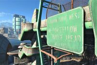
| Storrow Drive West
|
|
|
Runs along the southern shore of the Charles River.
|
|
| Storrow Drive East
|
|
|
Runs along the southern shore of the Charles River.
|
|
| Stuart Street
|
|
|
East-west from Mass Bay Medical Center.
|
|
| Sudbury Street
|
|
|
|
|
| Summer Street
|
|
|
|
|
| Surface Street
|
|
|
Northeast, then north, around the back of the Mass Bay Medical Center and through to downtown, by the Hub 360.
|
|
| Transit Court
|
|
|
At the end of the road entering Nuka World, near the entrance to Nuka Transit Center.
|
|
| Tremont Street
|
|
|
North-south from D.B. Technical High School, running past Combat Zone. The high school PA system reminds parents that the loading zone on Tremont is for buses only.
|
|
| Trinity Place
|
|
|
North-south from Trinity Plaza, by Trinity Tower, terminating in an on-ramp for the Mass Pike.
|
|
| Washington Street
|
|
|
|
|
| Water Street
|
|
|
|
|
| Home Street
|
|
|
One of four streets tracing the pre-War baseball diamond.
|
|
| First Street
|
|
|
One of four streets tracing the pre-War baseball diamond.
|
|
| Second Street
|
|
|
One of four streets tracing the pre-War baseball diamond.
|
|
| Third Street
|
|
|
One of four streets tracing the pre-War baseball diamond.
|
|


