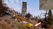
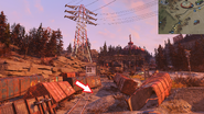
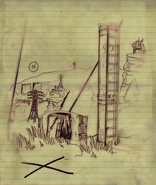
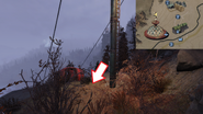
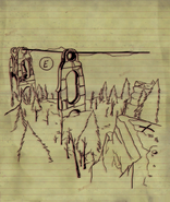
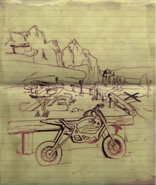
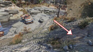
The Savage Divide treasure maps are a set of maps in Fallout 76. They lead to buried mounds hidden throughout the Savage Divide, all of which contain random valuable loot.
Location[]
The notes can be found throughout Appalachia, as randomized, rare loot in containers or on the bodies of Boss creatures. The treasure maps lead to:
- Map #01 leads to Federal Disposal Field HZ-21. The mound can be found along a southwestern fence, near a broken nuclear waste sign.
- Map #02 leads to the New Appalachian central trainyard, near the loading station.
- Map #03 leads to the base of a ski lift pylon with a crashed ski lift, north of Top of the World, overlooking power lines. Following the ski lifts down, there will be a sign pointing to different slopes named "incorrigable," "show off," and "lazy way." The pylon in question is the next one downhill of the sign. To find it from directly underneath Top of the World, look for a single blue sign for "Incorrigable," the northernmost set of lift pylons to the left(when facing north). The mound is next to the 5th pylon down the hill.
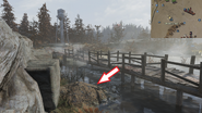
- Map #04 leads to Solomon's pond. Walk along the boardwalk there, and the mound will be sitting at the bottom of a rocky hill nearby.
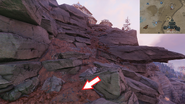
- Map #05 leads to directly east of Blackwater Mine. Look for a billboard on the rocks; the mound is located under the billboard face.
- Map #06 leads to down the cliffs which are north of the Palace of the Winding Path. Look for the tree that is broken in the middle.
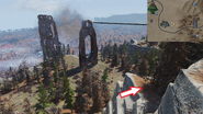
- Map #07 leads to a cliff facing a section of the monorail due east of South Mountain lookout. It can be accessed by descending the rock walls at the top of the mountain.
- Map #08 leads to the unmarked walking trail picnic area and vista, northwest of North Cutthroat camp. It is most easily accessed by fast traveling to Seneca Rocks, then following the railroad tracks south, and past a Blood Eagle checkpoint. Upon seeing the trail with wooden log barriers, follow the path to the picnic area. It will be in the dirt between the picnic area and the rocks of the cliff.
- Map #09 leads to a patch of flowers just south of Autumn Acre cabin. Go to the edge of the cliff south of Autumn Acre and look down until seeing a patch of four wild carrot flowers on another ledge below.
- Map #10 leads to the fissure site east of the Bailey family cabin where there are two abandoned trucks; the mound will be approximately fifteen meters in front of the higher of the two.

